As the mother city braces for heavy storms from tomorrow (Wednesday), operations at the Port of Cape Town are expected continue to continue without major disruptions, according to Transnet National Ports Authority (TNPA).
The South African Weather Service (SAWS) alerted the City of Cape Town’s Disaster Risk Management Centre to an intense cold front which was moving towards the Western Cape.
SAWS warned that this cold front would result in gale-force winds of up to 90 kilometres an hour along the south-western and southern coastlines. Wave heights are expected to be greater than six to eight metres south of Alexander Bay and were likely to reach up to 12 metres between Lamberts Bay and Cape Agulhas.
These high waves are projected to cause storm surges and damage to the coastal regions.
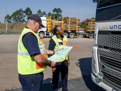
Cape Town’s acting harbour master, captain Yael Wearley, told FTW Online that officials would be closely monitoring the weather conditions and movements of vessels in and around the port. “We have taken all necessary precautionary measures to ensure the safety of vessels within the port and in the Table Bay area,” he added.